Blog Image

Hack writer

About this blog

This blog records occasional comments affecting hack riders' use of Epsom and Walton Downs, and other opportunities for riding in the neighbouring area.

Dorking Road horse ride

News Posted on 13 Aug, 2019 14:46

For many years, a ‘permissive path’ for horse riders has wound its way through the woodland west of Dorking Road, between Chequers Lane and Deans Lane. It provides a useful route for horse riders coming down Deans Lane from Walton Pond, either heading for Walton Heath along bridleway Banstead 100, or going to Headley Heath via Sturts Lane and Tye Lane (bridleway Banstead/Headley 494).

It’s been maintained, on and off, by top class Walton Heath golf club, which owns the woodland. Lately, it’s been increasinly hard to use, with fallen trees. However, the golf club ground staff have kindly cleared the route in the last few months, and it should now be fine to ride. Please report problems to the club secretary, secretary[atsymbol]waltonheath.com. Thanks to Tadworth and Walton Residents’ Association for alerting us to the recent improvement.

The map below shows the route. Do take care crossing from Chequers Lane to bridleway 100 — as with all crossings of Dorking Road, the traffic moves quickly. At the Deans Lane end, coming down from Walton-on-the-Hill, keep straight on at the bend, just after the turning to the club house, riding between the twee shrubs (not along the club house access road to the right), and then pick up the horse ride through the woods. Please don’t ride along footpath 97 further to the right, and avoid picking up footpath 96 by mistake where it diagonally crosses the horse ride at one of the crossing driveways. You can see the view at the turning from Deans Lane here, with the twee shrubs just ahead.

Remember, too, that Love Lane, linking Sturts Lane and Chequers Lane, is an unsealed public road open to all traffic — including horse riders!
map of Dorking Road path


Parking in front of the Derby Arms (2)

News Posted on 02 Sep, 2018 11:39

In June, I blogged that we had written to the chairman of the board of conservators to probe the board’s decision to establish new car parks on the downs, outside the Derby Arms, and in the triangle between Ashley Road, Langley Vale Road and the racecourse, for events parking.

After protracted correspondence with the council’s chief legal officer (acting for the board of conservators), we are none the wiser. The board has refused to cast any light on the powers which it intends to exercise, referring only to its original, and seriously defective, report to the board. We will now wait to see whether the proposals for implementation of the parking arrangements, which are to be set out in a management plan, are compatible with the limited powers which the board possesses to create new public car parks.

You can see the correspondence here, with the earliest exchanges first: our original letter to the chairman, then: 1, 2, 3, 4, 5, 6, 7 (all emails are printed with the most recent first, so start at the bottom of each document).


Parking in front of the Derby Arms (1)

News Posted on 22 Jun, 2018 08:46

At the conservators’ meeting on 18 June, the board approved proposals to authorise the racecourse to use land in front of the Derby Arms, and the triangle between Ashley Road, Langley Vale Road and the racecourse, for events parking — the paper is at agenda item 8 here.

The BHS responded to the consultation on the proposals earlier this year with a submission that the conservators have no power under the Epsom and Walton Downs Regulation Act 1984 to authorise use of the land for events car parking (included at pages 43–46 of the report). At the conservators’ board meeting this week, the board received a report from the clerk that it could authorise the proposed use — but as a public car park. We have written to the chairman of the board, Cllr Liz Frost, to clarify whether it really is the intention of the board to establish two new public car parks in these areas.


Epsom Vision

News Posted on 21 Apr, 2017 09:11

The Epsom Vision leaflet was distributed at the meeting of the board of conservators on 19 April 2017, where I’ve commented on it. I’ve subsequently kindly received an electronic copy courtesy of the racecourse which you can view here. Do take a look, or download the pdf: it’s about promoting Epsom as a centre of training for racing. Why does that matter to hack riders? Because it’s thanks to the racing industry, and the income it generates, that Epsom and Walton Downs are such a superb location for all riders. Take away the racing, and the funding, and the whole of the downs will end up as woodland.

Epsom Vision for racing on Epsom Downs, page 1

Epsom Vision for racing on Epsom Downs, page 2

Epsom Vision for racing on Epsom Downs, page 3


The hatched area

News Posted on 07 Mar, 2016 21:52

This notice has recently appeared east of Walton Road at the foot of Six Mile Hill. It reads: ‘HATCHED AREA CLOSED’. We asked for the sign to be erected. Why? Clearance at top of Rifle Butts Alley

The hatched area appears, duly hatched, on the statutory map deposited in Parliament with the Epsom and Walton Downs Regulation Bill (now the 1984 Act). The map legend explains: “Part of Walton Downs on which riding is permitted after noon if in the opinion of the Training Grounds Management Board conditions allow”. The hatched area extends along much of the bottom of Six Mile Hill, both east and west of Walton Road, below the training grounds, and above the Mac track. Apart from the claimed use of a sliver for occasional training west of Walton Road, it is not maintained for training, and useless for that purpose. But the Board is afraid that, if hack riders are ‘permitted’ to use it, they may stray north onto the training grounds. In 32 years, the Board has never expressed an opinion that conditions do allow, but at almost every Board meeting, it confirms that conditions do not allow. Of course, the Board’s disposition has nothing to do with ‘conditions’, and everything to do with its jealous conservation of the training grounds.

To remind hack riders that the hatched area should be open to riders’ use, at least at certain times, we asked the Board to erect a sign which shows whether ‘conditions allow’. One looks in vain for any simple mechanism on the sign (a sliding board perhaps?) to convert ‘closed’ into ‘open’, but perhaps that isn’t so surprising.


Top of Rifle Butts Alley

News Posted on 26 Nov, 2015 15:46

Officers and downskeepers have scheduled work over the winter of 2015–16 to clear some of the scrub from the top of Rifle Butts Alley (bridleway 66 from Burgh Heath Road). This will improve access for all users between the bridleway and the hack ride along the north perimeter of the golf course and the downs. Work is planned to include improving access along the hack ride itself, where scrub encroachment, by excluding the sun and wind, has caused the track to become waterlogged in wet weather.

Under the Epsom and Walton Downs Regulation Act 1984, all of the land north of the hack ride (between the hack ride and the boundary fence) is designated a hack area — even the area used as a green waste tip — so some clearance here is welcome thanks.

Clearance at top of Rifle Butts Alley


New common land at Buckland Hills

News Posted on 31 Aug, 2014 10:12

Last month, I blogged about the exchange land application pursued by Walton Heath golf club to release part of Beecham’s Field from its status as common land. The application was granted in July.

On Saturday, I unexpectedly discovered that club has already dismantled the fencing surrounding the lower part of the replacement land on Lady Hill, south-east of the Pfizer premises in Walton on the Hill. That means that walkers and riders on bridleway 477, which threads a narrow and at times awkward route around the southern perimeter of the replacement land, can now head straight across the open grassland in preference to the lower line of the bridleway, and enjoy the wonderful views south over the Surrey weald. However, do watch out for the fence post holes adjacent to the bridleway.

Here’s the view from the track, shown on the Ordnance Survey map, which runs east-west across the top of the slope: Lady Hill, looking south-east

and the view from further up Lady Hill, adjacent to Round Wood: Lady Hill, looking south from adjacent to Round Wood

Here is the view looking west back towards Dewriding Plantation. The fence along the edge of the field has been removed. At present, there is no physical access on horseback from the gateway onto the bridleway west to Buckland Lane, although it’s possible to pick up the bridleway a little lower down. Lady Hill, looking west to Dewriding Plantation


Walton Heath exchange granted

News Posted on 17 Jul, 2014 09:46

This is about Beecham’s Field on Walton Heath: a bit outside the usual scope of this blog, but one into which I got drawn owing to a colleague BHS access officer being away at the relevant time.

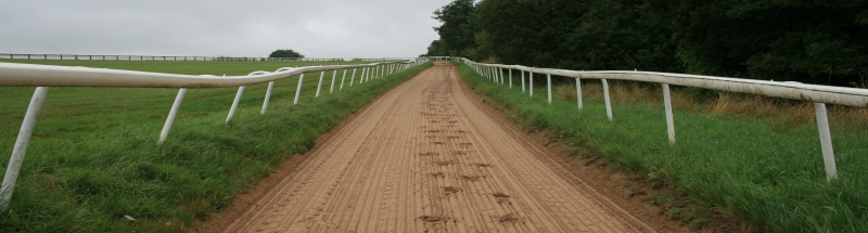
Walton Heath is an extensive area of common land, 202 hectares, register unit CL355 of the manor of Walton on the Hill, now largely adopted as a prestigious golf course. It’s owned by Walton Heath Golf Club, which maintains the course to a high standard, with some beautiful heathland covering much of the roughs. More remarkably, the heath is an ‘urban common’ subject to section 193 of the Law of Property Act 1925, which means there is a right of access for the public, including on horseback, subject to the order of limitation made by the former Minister of Agriculture. The order restricts access so as to cause damage: the BHS would therefore advise against riding on any of the tees, or on the fairways when the ground is damp or wet. It is politic to avoid riding on the fairways while the course is in play except as a means of crossing between roughs or public bridleways. The order also prohibits riding on the gallops, which were in use until the early post-war period for training horses, and which are still marked on the Ordnance Survey maps: however, since the gallops have long since ceased to be used for training, we think that the limitation in that respect is unenforceable (and it is unlikely that anyone would seek to enforce it).

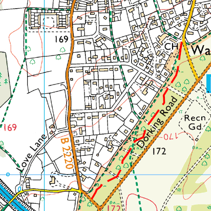
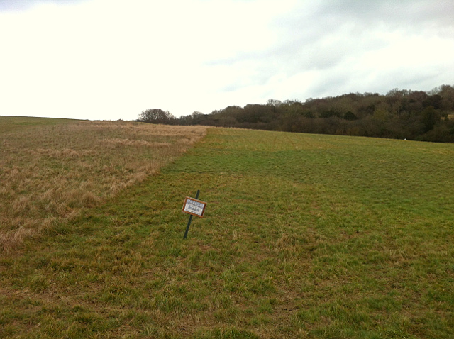
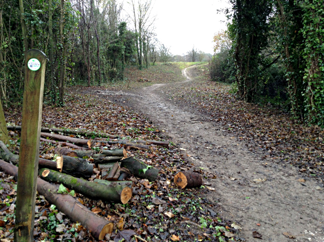
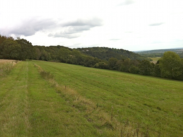
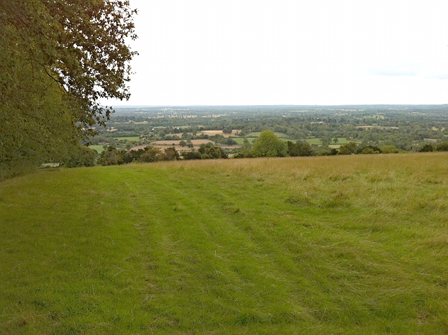
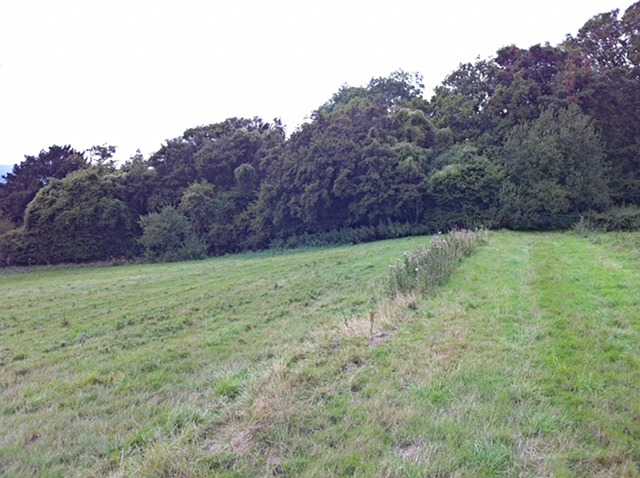
Beecham’s Field is primarily a practice driving area on the south side of Dorking Road south of the recreation ground. It is crossed by public footpath 96, and fringed by the western part of the gallop (now a hard surfaced service road). The golf club applied, under section 16 of the Commons Act 2006, to deregister all of the practice area north of the footpath, and (as it must) offered replacement land (to be registered as common land) south of the M25 above the line of public bridleway 477. The replacement land has good views over the Surrey Weald, but is quite distant from any substantial areas of population.

The application was considered at a four day public inquiry in May by a Planning Inspectorate inspector on behalf of the Secretary of State, and was opposed by Tadworth and Walton Residents’ Association and others, and by the BHS (see our speaking notes to the inquiry, and closing legal submission), while the golf club retained a QC and consultants to present its case.

In short, the inspector has now issued a decision letter (go here and look for Section 16 decision letters, COM491) which grants the application, and Beecham’s Field will soon be deregistered. The decision isn’t good for local people, and I regret the outcome from their point of view.

However, provided the club keeps to its undertakings given to the inquiry as regards the replacement land, it will remove the fences along bridleway 477 (allowing riders freely to enter the replacement land), it will ensure access for horses at each end off the bridleway (restoring to use a short-cut across the lower field with magnificent views south), and it will have entered into an enduring obligation to maintain the release land (which should prevent its scrubbing up in the way that has happened to other replacement land further east). All these undertakings were given to the inquiry, and all of them were requested by the BHS. The only bit we asked for but didn’t get was access to the replacement land direct south from the bridle bridge over the M25 (instead, riders coming this way will probably need to cross the old fields south-east from the bridge to join bridleway 477, then head back west).

So a quite satisfactory outcome considering we ‘lost’. And the views from the new land really will be rather good — and accessible to riders.

And note that at no time did the golf club contest the BHS view that riders could go anywhere on the golf course provided they did not cause damage. That is worthwhile in itself.


Woodland Trust Centenary Wood

News Posted on 18 Mar, 2014 22:22

The Woodland Trust has announced its intention to acquire 250 hectares of farmland at Langley Vale Farm to form one of four Centenary Woods to mark the anniversary of the start of the First World War. Over 200,000 trees are planned to be planted on the site over the next five years, and the embryonic woodland estate is likely to attract increasing numbers of visitors. An artistic impression of the estate can be seen here.

Plans for access (including paths for horseriders), planting and managing visitors are likely to be among the challenges raised at a public meeting hosted by the Woodland Trust at 1400 on Sunday 23 March, at Langley Vale Village Hall.


“Menacing dogs put an end to my rides”

News Posted on 19 Apr, 2012 19:47

The latest press report, this time in the Daily Telegraph, about dogs and riding on the downs. Follows this report in the Epsom Guardian about a distressing episode near Epsom Common.


Next »